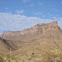
I have camped at Albert Pike Recreation Area upwards of 10 times in the last few years and was there a few weeks ago. It is 6 miles north of Langley, AR, and has a paved road all the way through.
The reporting on this tragedy is a little odd. I say that because the media keeps saying Caddo Gap and Caddo River, like they are right next to Albert Pike campground. Or that the Caddo River flows into the Little Missouri River. One website reported knowing of a flash flood ?watch before 9 PM on Wednesday night. Maybe those watch bulletins are put out so frequently people just ignore them.
http://arkansasbackcountry.forum-motion....0-t950.htm#8447The Little Missouri River (empties into Lake Greeson) flows right through Albert Pike Recreation Area, which has camping on both sides of the river there and backcountry camping along the river at Winding Stairs Campground. The river is normally 2-3 feet deep and we cross it a couple of times when hiking the Eagle Rock Loop Trail.
http://waterdata.usgs.gov/ar/nwis/uv/?site_no=07360200&PARAmeter_cd=00065,00060
The Caddo River (empties into De Gray Lake) flows near Caddo Gap, north of Glenwood, AR. It is about 20 miles east of the Little Missouri River.
http://waterdata.usgs.gov/ar/nwis/uv/?site_no=07359610&PARAmeter_cd=00065,00060


 Previous Topic
 Index
Index


