We are heading up north early Friday for a few days. One of the what if's that I have always thought about is, how would we get home if there was a major natural disaster (earthquake) that took out the bridges and tunnels on the roads back to home.
Using my scenario that if an earthquake were to hit and take out even one bridge and or a couple of tunnels, your drive home would cut be off completely and you have the below details and options to decide from on how to get home. (see the last paragraph for the main question)
Details:
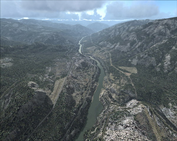
The highway we will be traveling up is an older 2 lane (with the occasional 4 lanes and passing sections) that traverses north through temperate rain forest then into one of the PNW's longest river canyon / mountain passes that eventually opens up into a semi arid region. The canyon area can see quite a bit of snow in winter.

In the summer, day time temperatures of 100F plus is very common and can last for weeks with little rain...if at all. The current average temperature today is 67F.

The area through the canyon is sparsely populated with only a few villages that only number in the low hundreds of people to a couple of small towns with less than 1000 people. The small towns only have the most basic of stores and gas stations and accommodations are limited.

On the highway route through the canyon, there are 2 crucial (and old) bridges that must crossed along with 5 tunnels and should be noted that neither the bridges nor the tunnels have ever been seismically upgraded. It is a well known fact that the bridges and tunnels are very vulnerable to an even a moderate earthquake. This picture shows a railroad bridge in the foreground. The highway bridge is in the background. Take note, it is suicide to attempt to swim cross that river here...

The only detours are to head back up north and take 2 alternate routes of which the first route is along a very narrow, windy mountain pass that sees snowfall in the tens of feet per year and daytime temperatures of 90F or more. This route has no services, and no towns or villages for over 70 miles in one area.
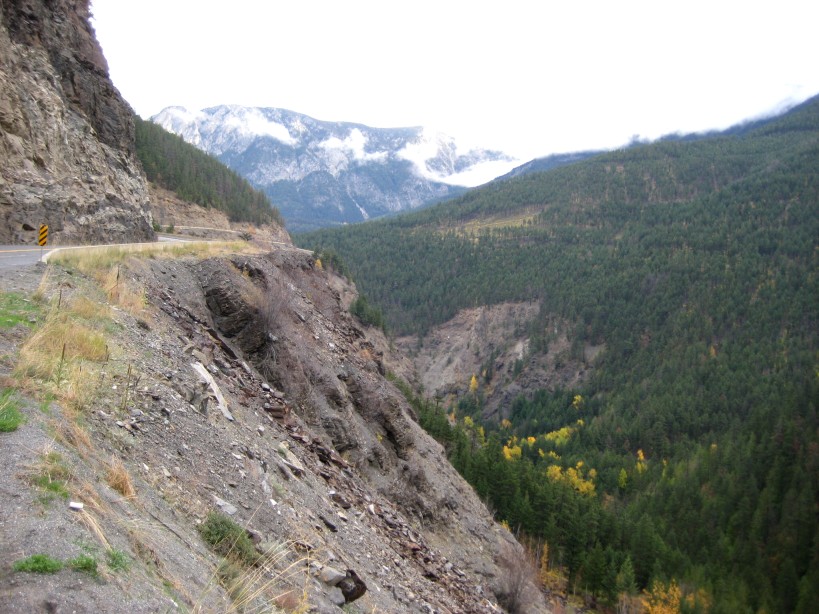
The second route is over a more modern 4 lane highway that traverses through some of the very rugged terrain which again receives tens of feet of snow in winter and high temperatures in summer. It should be noted that both these alternate routes have bridges that are vulnerable along with the chance of snow and rock slides. This is a much longer route (by having to first head back north and then swing to the east then eventually travel south.)

A few more details:
- On each side of the canyon and river are 2 separate train lines. These tracks also go over bridges and through various tunnels that may or may not be passable.
- The highway tunnels do not go under any water etc and a few of them may be bypassed by hiking/climbing around them one side or the other. Keep in mind that this is extremely steep country and it is not as simple matter of jaunt up and over a hill. That hike/climb around may take some hours.

- Even in the hot summer, water is available from many creeks. Due to the low population, pollution is generally not a problem, however keep in mind that water by nature can have it's own nasties that need to be dealt with.
- Due to the semi arid climate in most of the canyon, finding game or food is a real problem as I wrote above, the area is sparsely populated. That said, there is some small game and also deer, mountain sheep and the odd moose. Once you descend south out of the canyon into the beginnings of the PNW rain forest, your chance of finding edible food increases dramatically.
- Crossing the main river without a proper sized powered boat is suicide...people die every year on this river from not repsecting it's power. That said, if you were to attempt to traverse cross country and get out of the canyon which is not difficult in some areas, you will still need to cross the river at some point. Once out of the canyon and into the valley, the river is wide and fast flowing for any boat unless you are an expert canoeist or kayaker. Even if you were not able to travese the river yourself, this valley leads into a major metropolis and large population are where you may be able to get someone with a proper boat to get you across the river.
If you were caught in this earthquake scenario, and you chose for whatever reason to attempt to walk home (lets leave out the questions of why would you even try? etc) what gear and other resources would you want to have with you? This question is not based on the regular traveler who has usually takes nothing but a cup of coffee in his car, rather the question is for you who travels equipped to survive.


 Previous Topic
 Index
Index


