#247909 - 07/03/12 01:47 PM
 Cell phone GPS
|

Enthusiast
Registered: 08/17/09
Posts: 305
Loc: Central Oregon
|
I am researching to find out how a iPhone/Anroid cell phone GPS works. I've heard that some phones get GPS data from cell towers while other phones have a stand alone GPS receiver/system. I'd appreciate some feedback and references. Thank you, Blake www.outdoorquest.blogspot.com
|
|
Top
|
|
|
|
|
#247911 - 07/03/12 02:41 PM
Re: Cell phone GPS
[Re: Outdoor_Quest]
|
Member
Registered: 03/29/12
Posts: 189
Loc: California
|
However, I have read that most smart phones don't maintain local copies of the maps, so you still need to be in cellphone range to use GPS mapping. I also wonder if you can get topo maps on a cellphone.
|
|
Top
|
|
|
|
|
#247914 - 07/03/12 02:58 PM
Re: Cell phone GPS
[Re: Outdoor_Quest]
|
"Be Prepared"
Pooh-Bah
Registered: 06/26/04
Posts: 2212
Loc: NE Wisconsin
|
There are apps that allow maps to be uploaded, but I haven't tried them as yet. I still rely on "real" GPS units for my navigation - both on the road and off ... in addition to paper maps.
I have a friend (actually my son's Scoutmaster) who works for a recently purchases mobile phone company. I asked him about the details of GPS location on smart phones, and he pretty much said what Doug just said. They have GPS chip sets AND have the ability to triangulate via cell towers using signal strength to provide pretty good location without the GPS chip.
I lost my faith in the smart phone navigation when this Scoutmaster missed several turns on the way up to summer camp because his smart phone lost signal (or at least "hesitated" in its updating) just before the turns came up. My Garmin Nuvi simply does not do that.
My previous Nuvi had a tendency to reboot spontaneously and ultimately refused to start up one evening ... in downtown Detroit ... in the pouring rain ... with the battery in my smart phone almost dead. Sigh. Luckily my smart phone had enough power to get me back up onto the highway - where at least I knew where I was. I bought a new Nuvi on the way home the next morning.
Edited by KenK (07/03/12 03:06 PM)
|
|
Top
|
|
|
|
|
#247916 - 07/03/12 03:10 PM
Re: Cell phone GPS
[Re: Outdoor_Quest]
|
Veteran
Registered: 08/31/11
Posts: 1233
Loc: Alaska
|
I am researching to find out how a iPhone/Anroid cell phone GPS works. Both iphone and Android have internal GPS. When they don't recieve a satellite signal (for example indoors) my understanding is that they triangulate from cell towers, which is less accurate. However, I have read that most smart phones don't maintain local copies of the maps, so you still need to be in cellphone range to use GPS mapping. I also wonder if you can get topo maps on a cellphone. There are aps available for the iphone with which one can download local copies of maps. I have not tried them, so I cannot speak to how well they work. While I use my iphone extensively as a GPS in town, and sometimes carry it as a back when hiking, I don't consider it a substitute for a regular GPS for wilderness use. My experience is that using the GPS sucks the iphone batteries down rather fast. Also, iphones are somewhat fragile and don't like getting wet. Other smart phones may be less susceptable to these problems. I really like my iphone for in town use, but out in the woods, I rely primarily on traditional navigation with a map and compass, using a stand alone GPS when necessary.
_________________________
"Toto, I've a feeling we're not in Kansas any more."
-Dorothy, in The Wizard of Oz
|
|
Top
|
|
|
|
|
#247918 - 07/03/12 04:32 PM
Re: Cell phone GPS
[Re: Outdoor_Quest]
|
Carpal Tunnel

Registered: 08/03/07
Posts: 3078
|
I currently use a Samsung GT-B2710 phone which has an inbuilt LED flashlight, Electronic Compass, FM Radio and GPS (which is sensitive enough to work indoors) using a JAVA app called 'UTM Data', which will convert the GPS WGS-84 coordinates generated from the internal GPS receiver to a host of other datums such as OSGB36, MGRS and UTM etc for paper map use i.e the UK Ordnance Survey 1:50,000 and 1:25,000 Topographic paper maps. The phone is unlocked, has excellent battery life, and easily charged using a Sunlinq 6W panel or external Lithium Battery pack etc. www.youtube.com/watch?v=0vHfKq8CREkDo not attempt this with your $600 iPhone.  For electronic mapping I also use a Ployer Momo 9 (Android) Tablet PC with the Maverick Pro App (no inbulit GPS or 3G, although a 3G USB dongle can be attached to the USB port). This allows me to cache most download maps that are available including OSGB (except it seems Google Maps). This gives me even more extensive electronic mapping capabilities for the UK than even the Satmap Active 10 Plus GPS (typically costs £300). SD cards for complete OSGB electronic map coverage of the UK may add another £300-400 The Ployer is cheap at around £100 and maps are cached on a 16GB micro SD card when working without any WiFi or 3G connection. The main problem with electronic mapping and navigation is the compromise between display size and weight, battery life, fragility and the manufacturers insistence of using their own non standard mapping formats, for which you pay a hefty price, whilst the some companies (Google, Apple ahem) like to keep a track of where you are. The main advantage is the amount of data that can be stored on a microSD is very impressive. i.e Coverage of just Scotland on highly detailed OSGB 1:25000 topographic paper maps would weigh many times the weight of the tablet computer itself. If going lightweight for a weekend I would just take a paper map/compass and the Samsung Phone (mainly for communications if within network coverage and for the occassional GPS fix if visibility is very poor). The Ployer Momo 9 might come along if it was a bug out situation.
Edited by Am_Fear_Liath_Mor (07/03/12 04:53 PM)
|
|
Top
|
|
|
|
|
#247921 - 07/03/12 06:37 PM
Re: Cell phone GPS
[Re: Outdoor_Quest]
|
Addict
Registered: 03/18/10
Posts: 530
Loc: Montreal Canada
|
My phone can use GPS (5 meters accuracy), and if it's off it'll use cell tower triangulation (500~1000 meters or so accuracy, or if wifi is on and there are access points around it'll use WPS (almost as good as GPS in populated area with a lot of WIFI signals).
As far as map goes, if you use an ONLINE map service such as google map obviously it won't work when there is no signal (though you can pre cache area in gmap if you choose). You can download navigation apps or topo map apps that will store them locally, I have sygic navigation installed for back up. (though you do need a couple of GB of free space for the maps, 4.7 GB in my case)
|
|
Top
|
|
|
|
|
#247996 - 07/05/12 09:00 AM
Re: Cell phone GPS
[Re: Outdoor_Quest]
|
Veteran

Registered: 07/23/08
Posts: 1502
Loc: Mesa, AZ
|
Well I have never had luck with my iPhone off grid, out of cell range, using my GPS. I just don't rely on it out of cell range.
But for those of you who geocache in cell areas, the geocaching.com app is amazing on the iPhone. I haven't had to use my dedicated gps in years to look for caches.
_________________________
Don't just survive. Thrive.
|
|
Top
|
|
|
|
|
#248139 - 07/07/12 09:23 PM
Re: Cell phone GPS
[Re: Treeseeker]
|
Veteran
Registered: 12/12/04
Posts: 1204
Loc: Nottingham, UK
|
However, I have read that most smart phones don't maintain local copies of the maps, so you still need to be in cellphone range to use GPS mapping. Google Maps recently added an option to store selected maps on the phone. Actually they've had it for a while, but it was a "Lab" beta feature. Now it is part of the core product. It's in version 6.9.0. Press Menu, then "Make available offline".
_________________________
Quality is addictive.
|
|
Top
|
|
|
|
|
#248201 - 07/09/12 01:59 PM
Re: Cell phone GPS
[Re: haertig]
|
Stranger
Registered: 07/06/12
Posts: 3
Loc: U.S.A.
|
I use the TomTom app on my iPhone and it works great when the cell network is unavailable. Unlike the iPhone maps and some other GPS mapping apps that rely on the ability to download maps real-time, TomTom has the maps stored in the phone memory. Admittedly, it isn't going to do topos, etc, but it'll get you around as long as the satellites are still there!  On a side note -- One thing I like about the iPhone "maps" app is that if you zoom in very close on the "map view", it will show you the county property lines and is usually accurate within several feet. Great for knowing what piece of land you're on!
|
|
Top
|
|
|
|
|
#248214 - 07/09/12 04:59 PM
Re: Cell phone GPS
[Re: Patriot_RAM]
|
Old Hand
Registered: 03/01/07
Posts: 1034
Loc: -
|
There are plenty of GPS mapping applications available on the smartphone market. Many of them will easily beat any modern standalone solution in terms of usability, convenience and features, even without data connection available. The problem with them is the smart phone itself. It has limited battery life, not rugged enough, its GPS antenna is tiny, and it is prone to software crashes and weird glitches. It is possible to overcome most of that by selecting a good field smart phone in the first place. Forget the iPhone. Get Android. My personal choice is Motorola Razr Maxx on Verizon network ( just as an example of a good choice: large battery, OLED screen, rugged case). Then add Otterbox Defender case, buy a decent external battery with USB port (and perhaps a solar panel), refrain from "playing with apps" on your phone (or at least be observant for "bad" applications and make backups often). To overcome weak antenna issues - get an external BT GPS receiver module (e.g. Holux, providing 20 hr of battery time).
|
|
Top
|
|
|
|
|
#248245 - 07/10/12 05:18 AM
Re: Cell phone GPS
[Re: Outdoor_Quest]
|

Addict

Registered: 06/29/05
Posts: 648
Loc: Arizona
|
I have been quite surprised at how effective of a navigation tool an iPad or iPhone can be. To date the only limitations I have noticed is the rechargeable battery, but in the many circumstances with the right software I actually prefer the iPhone or iPad to a standalone real GPS. One of the most common concerns I hear about the iPhone is in regard to its durability. But, the right case can solve that (OtterBox or Lifecase). The key to making the iPhone a usable GPS unit in the field is the right software. I use a number of different programs depending on what I am doing. All of these programs allow maps to be downloaded and stored directly on the iPhone. GaiaGPS($9.99), GPSKit($9.99), and PDF Maps(Free). GaiaGPS is probably the best GPS application for most users, and all indications are that it is only going to become more versatile with future updates. GaiaGPS allows you to download maps in a number of formats and import (and export) GPX and KML files. When downloading map files you not only choose the area you want but also the zoom level to customize the file to your needs and available space. I have tried a number of GPS/Map applications (47 to be exact) looking for the best one. GaiaGPS is the best GPS application for backcountry navigation I have found. 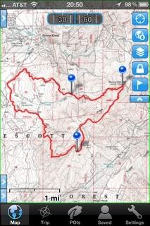 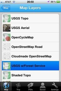 GPSKit is a close second to GaiaGPS, but the GaiaGPS greater (and simpler) map options give the advantage over GPSKit. That being said, GPSKit is a slightly better application for working with KML and GPX files, and I still use it when I am working with very large GPX or KML files. GPSKit does have some features GaiaGPS doesnt have; A dashboard screen (that is similar to the Garmins Trip Computer screen) Squak mode which allows you to share your location and other information with other GPSKit users (I havent tried this feature). 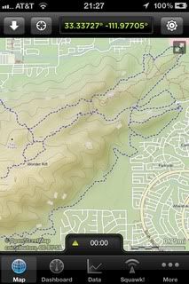 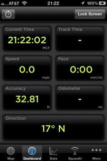 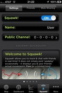 PDF Maps is a free application, and actually pretty limited (compared to GaiaGPS of GPSKit) in what you can use it for. However, it has one feature that makes it an absolute must have (especially since it is free). PDF Maps is simply a reader for GeoPDF files, with a few navigation tools added. GeoPDF are PDF maps coded with location data. You can download these directly from the built in store in PDF Maps (many of the maps are free) or from USGS website and many National Forest websites. The navigation functions are more limited but is does allow you to mark waypoints, import KML files, Geo-code photos (which the iPhone does already) and import and export KML and GPX files. I primarily use this app to view the GeoPDF maps at wildland fires. 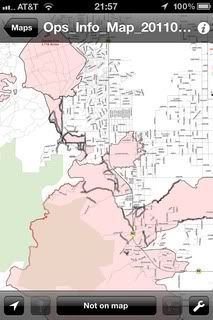 I do still use my real GPS units, but find myself doing so less and less. With portable solar charges and smaller and lighter battery packs becoming available, the iPhone will only become more usable in the field as a GPS unit. The battery life isnt really that bad as it is, with normal settings (everything on) my iPhone 4 will run for more than 24 hours with my normal level of usage. If I am using it as a GPS in the backcountry I set it to Airplane mode (the GPS still works in this mode), in this configuration using GaiaGPS for tracking I have been able to track for over 5 hours and still have well over half my battery life remaining. I have not used the iPhone to track longer than 5 hours. While still not a replacement for a paper map and compass, the iPhone is starting to replace my real GPS units more and more.
Edited by Alan_Romania (07/12/12 02:06 AM)
_________________________
"Trust in God --and press-check. You cannot ignore danger and call it faith." -Duke
|
|
Top
|
|
|
|
|
#248278 - 07/10/12 07:17 PM
Re: Cell phone GPS
[Re: Outdoor_Quest]
|
Stranger
Registered: 03/20/07
Posts: 23
Loc: Brasília, Brazil
|
I do not count on my Iphone as primary navigation aid, but I have to admit that it saved the day in more than a few situations. I have tried some navigation Apps, and the MotionX is the one that I liked most. With this application you can download maps and satellite imagery from some sources, including Google earth imagery. What I usually do is navigate in the Iphone App around the area I will travel, to download the google satellite images to the buffer memory. So, I can have the images even without cell phone signal, what happens a lot around I usually hike. When hiking, I always keep the Iphone in flight mode and only switch to normal operation when I need a GPS fix or want to check the satellite images. In flight mode the battery last for days without recharging.
Edited by Alan_Romania (07/12/12 02:04 AM)
Edit Reason: fixed link
|
|
Top
|
|
|
|
|
#248355 - 07/11/12 10:49 PM
Re: Cell phone GPS
[Re: Outdoor_Quest]
|
Addict

Registered: 02/02/03
Posts: 648
Loc: North Texas
|
|
|
Top
|
|
|
|
|
#250990 - 09/15/12 06:22 PM
Re: Cell phone GPS
[Re: Outdoor_Quest]
|
Veteran
Registered: 07/23/08
Posts: 1502
Loc: Mesa, AZ
|
Bump.
Question for you guys that have used multiple smartphone navigation apps. I have decent GPS skills but get lost in the terms and meaning companies give for what their units or software can do.
Which apps allows BOTH in and out of cell tower range, the ability to plug in a coordinate (specifically Lat/Long and UTM)and then give distance, direction, data like a dedicated GPS?
It just seems to me reading all the app pages and editorials that if your out of cellservice using a cached map smartphone navigation app, that you can not plug in a coordinate and create a route for it. Everything has to be a waypoint done while the phone is in cell range.
I do a lot of training where I am given coordinates and have to get there, like in orienteering events and those are mostly done in areas with no cell service. And even in urban environments, I find my current crop of nav apps lacking in the ability to plug in a grid coord and go there. They have to be a POI or street address.
_________________________
Don't just survive. Thrive.
|
|
Top
|
|
|
|
|
#251089 - 09/19/12 06:58 PM
Re: Cell phone GPS
[Re: comms]
|
Old Hand
Registered: 03/01/07
Posts: 1034
Loc: -
|
My short answer: I'm using the free "GPS Essentials" app on my Android Phone for what you want. No opinion for the iPhone, most likely again: "Because you don't need that".
A bit longer:
Sure thing, if you are using the cloud based app (like preinstalled Google Maps) on your phone - most of its functionality is implemented on the server, not in the phone app, which is just a web browser tailored to the task.
|
|
Top
|
|
|
|
|
#251245 - 09/28/12 09:02 PM
Re: Cell phone GPS
[Re: Patriot_RAM]
|
Pooh-Bah
Registered: 01/21/03
Posts: 2205
|
I also use the TomTom App on my iPhone and am happy with it. Since it has a full basemap on board, you never miss a turn because the data network is slow. It takes about 1.4GB of space on the phone, which is fairly large, but I much prefer having a "real" GPS mapping solution in hand, especially when I spend so much time in places with really poor mobile data coverage (that would be New York City and Los Angeles).
|
|
Top
|
|
|
|
|
#251246 - 09/28/12 09:04 PM
Re: Cell phone GPS
[Re: Fabio]
|
Pooh-Bah
Registered: 01/21/03
Posts: 2205
|
Drives me batty that the GPS receiver turns off in Flight mode. WHY? I have a basemap installed, would love to see exactly where I am over the USA.
|
|
Top
|
|
|
|
|
#251248 - 09/28/12 10:03 PM
Re: Cell phone GPS
[Re: Since2003]
|
Carpal Tunnel
Registered: 08/03/07
Posts: 3078
|
Drives me batty that the GPS receiver turns off in Flight mode. WHY? Flight or Airplane mode will turn off the following; Cellular (voice and data) Wi-Fi Bluetooth GPS Location services If the iPhone is not using Cellular, Wi-Fi, BT etc then GPS isn't required for Apple to keep track of your location. to cross correlate against Wi-Fi locations and associated MAC addresses etc http://www.youtube.com/watch?v=GynEFV4hsA0
Edited by Am_Fear_Liath_Mor (09/28/12 10:08 PM)
|
|
Top
|
|
|
|
|
|
|
1
|
2
|
3
|
4
|
5
|
6
|
|
7
|
8
|
9
|
10
|
11
|
12
|
13
|
|
14
|
15
|
16
|
17
|
18
|
19
|
20
|
|
21
|
22
|
23
|
24
|
25
|
26
|
27
|
|
28
|
29
|
30
|
|
|
|
|
|
|
0 registered (),
1200
Guests and
3
Spiders online. |
|
Key:
Admin,
Global Mod,
Mod
|
|
|


 Previous Topic
 Index
Index


