This will probably be trivial stuff for you hiking pros but I thought Id share some lessons learned from a hike I took yesterday.
1. Make a checklist: I managed to leave behind my hiking staff, the dogs tie out rope, his water dish and a few other little things. Since we were hiking in a forested state park finding a new staff wasnt hard.
2. Study the topo maps more thoroughly before hand: The trail was only about 5 miles long but it seemed like 4 of them were up and down some pretty steep slopes. Might have picked a different trail had I done my homework a little better.
3. Pay attention: Several times I missed a blaze and had to re-trace my steps. Never really worried about getting lost as this is state park in a suburban county, a few miles in any direction would lead me to a McDonalds (Ridley Creek State Park in Delaware County, PA)
4. Practice more with my GPS: Forgot to set the waypoint at the parking lot, but could have back walked the trail. What was very handy was a hardcopy map of the park trails in a ID badge holder hanging on a neck strap.
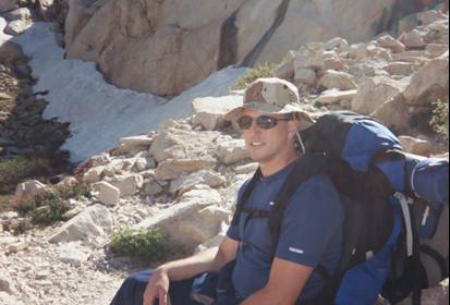
5. If something seems wrong with your equipment, stop and check it out: The pouch holding my Jetboil PCS came loose and could have fallen off. I felt something flopping around but didnt check it, should have. (BTW, thats a pretty nice bit of gear, had my water boiling in just a couple of minutes)
6. Remember in which direction the sun is: the south facing slopes tend to defrost sooner than those in the shade and thus can become slippery (whoa nelly!)
This is the first longish walk Ive taken with the dog. We normally do a mile or two every day, mostly on streets or graveled park trails. This trail was through heavy woods and was not well groomed. The dog did fine, he didnt need to stop and rest as much as I did. He did display an annoying habit of walking down the center of the trail and pushing me off to the side when it narrowed. I use a very short leash and he must walk at the heel position at al times. Might have to go to a slightly longer leash so we dont have to squeeze thru the narrow spots at the same time.
Here's a map of the hike on
EveryTrails. I use a Magellan Triton 400 GPS. Carry that and my Kenwwod ham HT in a chest pouch from
Civilian Lab . Nice setup.
Thanks for indulging...


 Previous Topic
 Index
Index


