Equipped To Survive Equipped To Survive® Presents
The Survival Forum
Where do you want to go on ETS?

Page 3 of 5 < 1 2 3 4 5 >
Topic Options
#178161 - 07/30/09 02:12 PM Re: Garmin Dakota 20 GPS Review heavy picture warning [Re: Am_Fear_Liath_Mor]
GoatRider Offline
Old Hand

Registered: 08/28/04
Posts: 835
Loc: Maple Grove, MN
Originally Posted By: Am_Fear_Liath_Mor

Great review, but I still prefer the old ways. grin

Don't forget

_________________________
- Benton

Top
#178163 - 07/30/09 02:33 PM Re: Garmin Dakota 20 GPS Review heavy picture warning [Re: GoatRider]
Am_Fear_Liath_Mor Offline
Carpal Tunnel

Registered: 08/03/07
Posts: 3078
Actually I'm looking to get hold of a Sextant to use for celestial navigation and use it with an old Palm PDA using CELESTNAV software. The GPS broadcast signals might not always be there. whistle

If I was to upgrade to a mapping GPS it probably would be the Satmap Active 10, which uses dedicated 1:25,000 Ordnance Survey maps, i.e. the same paper maps as the ones in the previous post.

http://www.satmap.com/about.php

A shootout review between the Active 10 VS Garmin Colorado 300 VS Magellan eXplorist 600 is pretty interesting. (the Garmin didn't do so well)

http://www.youtube.com/watch?v=CJyt3RFycsE


Edit - Hmm Maybe I won't upgrade to the Satmap Active 10 after all if the cost of the SD card maps are anything to go by. I think I'll just stick to the paper maps.


Edited by Am_Fear_Liath_Mor (07/30/09 02:57 PM)

Top
#178726 - 08/05/09 09:07 PM Re: Garmin Dakota 20 GPS Review heavy picture warning [Re: Am_Fear_Liath_Mor]
GPSFix Offline
Stranger

Registered: 08/05/09
Posts: 1
Loc: N42.5 W71.5
Good review. I've been looking around for a Dakota / eTrex comparison. I'm curious, how do you compare the GPS reception of the Dakota to the eTrex HCX? I've done a lot of comparisons between the Dakota, Oregons, Colorado and 60CSx's but I don't have an eTrex to compare with.

My review of the Dakota is here: http://www.gpsfix.net/gamin-dakota-20-first-impressions/

I agree on the screen visibility issues, the backlight is weaker than other units and the reflectivity of the screen is not as good as the 60csx (and based on your review the eTrex) under bright light.


Top
#178736 - 08/05/09 11:31 PM Re: Garmin Dakota 20 GPS Review heavy picture warning [Re: GPSFix]
Eugene Online   content
Carpal Tunnel

Registered: 12/26/02
Posts: 2995
if you weren't so far away I'd bring over my etrex to compare.

Top
#178745 - 08/06/09 12:34 AM Re: Garmin Dakota 20 GPS Review heavy picture warn [Re: falcon5000]
scafool Offline
Pooh-Bah

Registered: 12/18/08
Posts: 1534
Loc: Muskoka
Thank you for the review. I am still using my old etrex and my old GPSIII. They are both getting old and it is nearly replacement time.
_________________________
May set off to explore without any sense of direction or how to return.

Top
#178777 - 08/06/09 12:19 PM Re: Garmin Dakota 20 GPS Review heavy picture warn [Re: scafool]
Eugene Online   content
Carpal Tunnel

Registered: 12/26/02
Posts: 2995
Anyone have the Oregon with the camera, is the camera decent? I was looking to buy a cheap digital camera for carrying with me for times we don't want to carry our big camera but wondered if maybe I should just put that $100 toward upgrading.

Top
#178814 - 08/06/09 09:56 PM Re: Garmin Dakota 20 GPS Review heavy picture warning [Re: GPSFix]
falcon5000 Offline
Addict

Registered: 09/08/05
Posts: 662
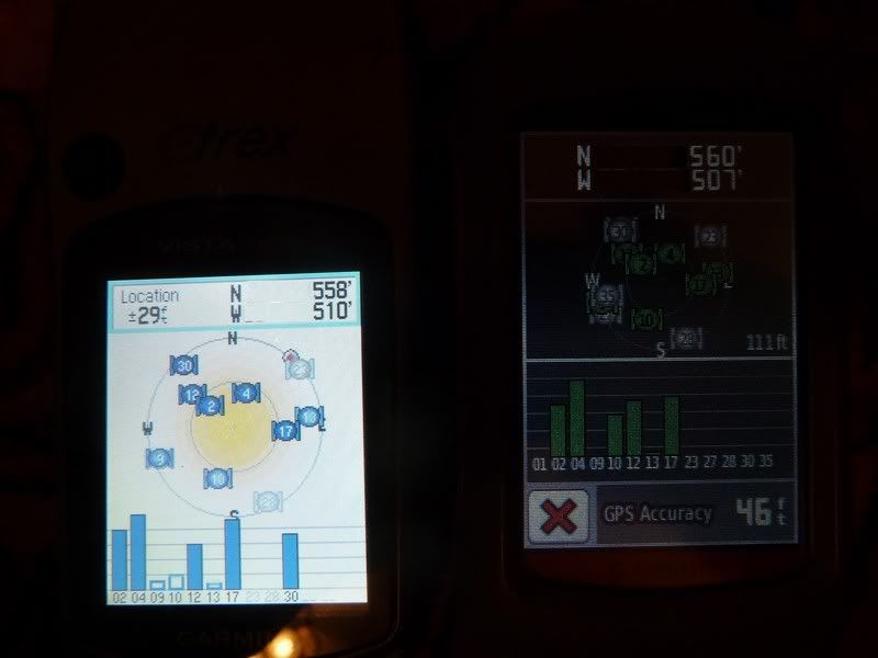
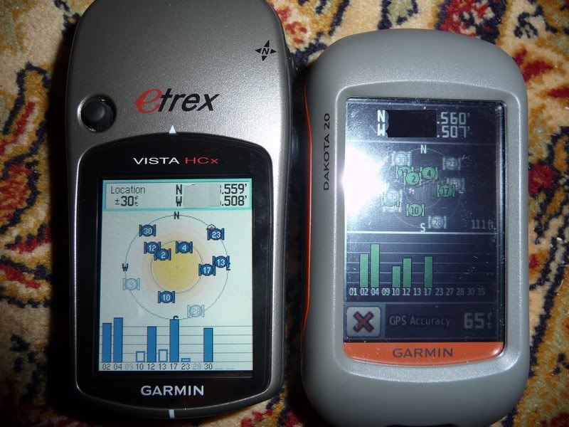
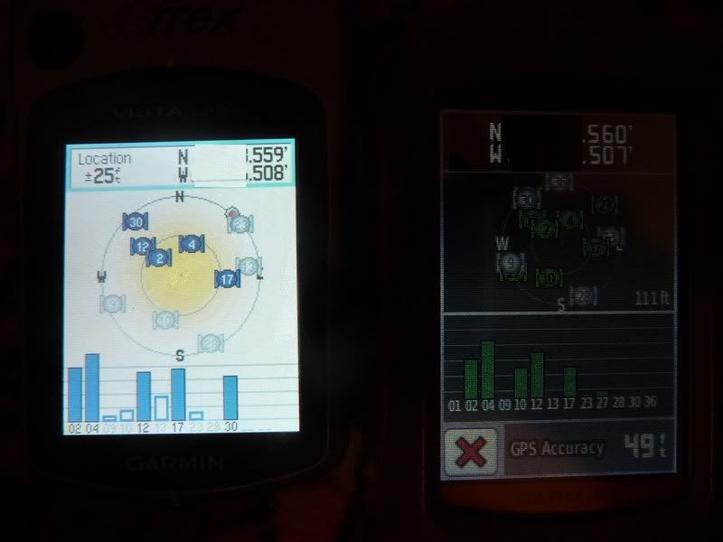
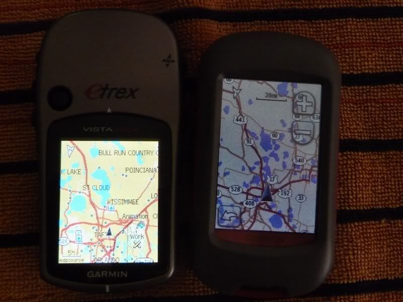
GPSFix, That's a lot better review than mine, night and day difference. These pictures below are just a quick example that I shot real quick and yes some of the Lat and Long are chopped a little (not that it wouldn't take you 3 secs to really locate this position) but anyway here is my brief observation. Your analysis on the accuracy of the Dakota is the spot on where mine is very crude. Overall the Dakota gave steady readings and the HCX varied quite a bit, the Dakota locks on instantly but as you said it is probably the hot fix. The Delome Topo 8 was used as a baseline and I used the fixed map readings and not the bluetooth earthmate GPS. The Dakota was the most accurate in elevation, and for Lat and Long the HCX was closer but the readings varied quite a bit. So who's right?
This is only a quick sample though.
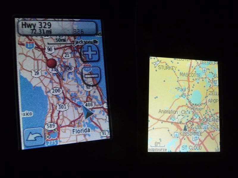
Overall I've manage to store a whole lot of maps on 2- 4 gig micro SD cards which you can store both in the battery compartment but only one in the unit which I like. I'm still experimenting with maps right now. Also I wish they would let you customize the routing like quickest or shortest. It routes you through back roads to much when using it in car mode. Minor software fixes needed but Garmin has always been good with that. I'm actually starting to like it more than the HCX (except for the screen). That's the biggest issue I have is with the screen. The HCX is still all in all the better of the units for overall functions but the Dakota has more capability and I love how small this thing is. It's a little powerhouse when loaded up and is so much faster than the HCX in doing everything. HCX is like a M-1 to a M-16, HCX is old tried and true, the Dakota is hopefully a start on more better units to follow.


HCX
25-30 feet elevation
Lat N 558-560
Long W 508-510
Dakota
111 feet elevation
Lat N 560
Long W 507
Delorme Topo 8 (Very accurate base map)(I trust this data)
79 feet elevation
Lat N 496
Long W 554


_________________________
Failure is not an option!
USMC Jungle Environmental Survival Training PI 1985

Top
#179242 - 08/13/09 11:40 PM Re: Garmin Dakota 20 GPS Review heavy picture warning [Re: falcon5000]
falcon5000 Offline
Addict

Registered: 09/08/05
Posts: 662
Got the power cord in tonight, it will run the unit with no batteries, it uses the same cord as the Oregon. The power cord came from Garmin and is long and well built. Also tomorrow if I can get a chance, I'm going to experiment with the least solar capability. I have a 40 watt military cell and 4- 5 watt cells (20 Watts) and I will see what it takes to run it with no batteries in the unit. I am highly confident the 40 watt will be no problem, I'm just wondering how low of wattage will run it. As for micro SD cards, after experimenting more with it, here is what I can store in the battery compartment (water tight and secure).
The map experimental capabilities tested are as follows.
I can store 3 micro in the units battery compartment without interference. One card in the slot and 2 of them directly on top clears it from being pressed on by the batteries. What that means is I have 3 cards in the unit with these maps on board:

3- Micro SD cards total, all fits into the battery compartment.
(2- 4 gig SDHC Micro SD card and 1-2 gig Micro SD card)

Africa Street Map
Atlantic blue chart Portugal Azores
Australia Street Map
Borneo Street Map
Brazil Street Map
Canada Street Map
Caribbean Street Map
China Street Map
Europe Street Map
Indian Ocean
Japan Street Map
Malsing Street Map
Mexico Street Map
Middle East Street Map
New Zealand Street Map
Taiwan Street Map
Thailand Street Map
United States Street Map
24k Topographic US East, Central, West
_________________________
Failure is not an option!
USMC Jungle Environmental Survival Training PI 1985

Top
#179243 - 08/13/09 11:45 PM Re: Garmin Dakota 20 GPS Review heavy picture warning [Re: falcon5000]
falcon5000 Offline
Addict

Registered: 09/08/05
Posts: 662
And as for the power cord it made the screen brighter than the batteries which I wonder if they have a power restriction programed in it that could later be lifted. I want to test it in the sun to see the difference as well. Still nowhere as bright as the HCX.

Power Cord No Batteries


Batteries
_________________________
Failure is not an option!
USMC Jungle Environmental Survival Training PI 1985

Top
#179244 - 08/13/09 11:47 PM Re: Garmin Dakota 20 GPS Review heavy picture warning [Re: falcon5000]
falcon5000 Offline
Addict

Registered: 09/08/05
Posts: 662
Tomorrow testing Solar Day, and I wanted to thank the friends who let me borrow the maps for testing, it's a shame I can't keep them frown.
_________________________
Failure is not an option!
USMC Jungle Environmental Survival Training PI 1985

Top
Page 3 of 5 < 1 2 3 4 5 >


Moderator:  Alan_Romania, Blast, cliff, Hikin_Jim 
April
Su M Tu W Th F Sa
1 2 3 4 5 6
7 8 9 10 11 12 13
14 15 16 17 18 19 20
21 22 23 24 25 26 27
28 29 30
Who's Online
1 registered (Eugene), 408 Guests and 19 Spiders online.
Key: Admin, Global Mod, Mod
Newest Members
Explorer9, GallenR, Jeebo, NicholasMarshall, Yadav
5368 Registered Users
Newest Posts
Corny Jokes
by wildman800
10:40 AM
People Are Not Paying Attention
by Jeanette_Isabelle
04/19/24 07:49 PM
USCG rescue fishermen frm deserted island
by brandtb
04/17/24 11:35 PM
Silver
by brandtb
04/16/24 10:32 PM
EDC Reduction
by Jeanette_Isabelle
04/16/24 03:13 PM
New York Earthquake
by chaosmagnet
04/09/24 12:27 PM
Bad review of a great backpack..
by Herman30
04/08/24 08:16 AM
Our adorable little earthquake
by Phaedrus
04/06/24 02:42 AM
Newest Images
Tiny knife / wrench
Handmade knives
2"x2" Glass Signal Mirror, Retroreflective Mesh
Trade School Tool Kit
My Pocket Kit
Glossary
Test

WARNING & DISCLAIMER: SELECT AND USE OUTDOORS AND SURVIVAL EQUIPMENT, SUPPLIES AND TECHNIQUES AT YOUR OWN RISK. Information posted on this forum is not reviewed for accuracy and may not be reliable, use at your own risk. Please review the full WARNING & DISCLAIMER about information on this site.